
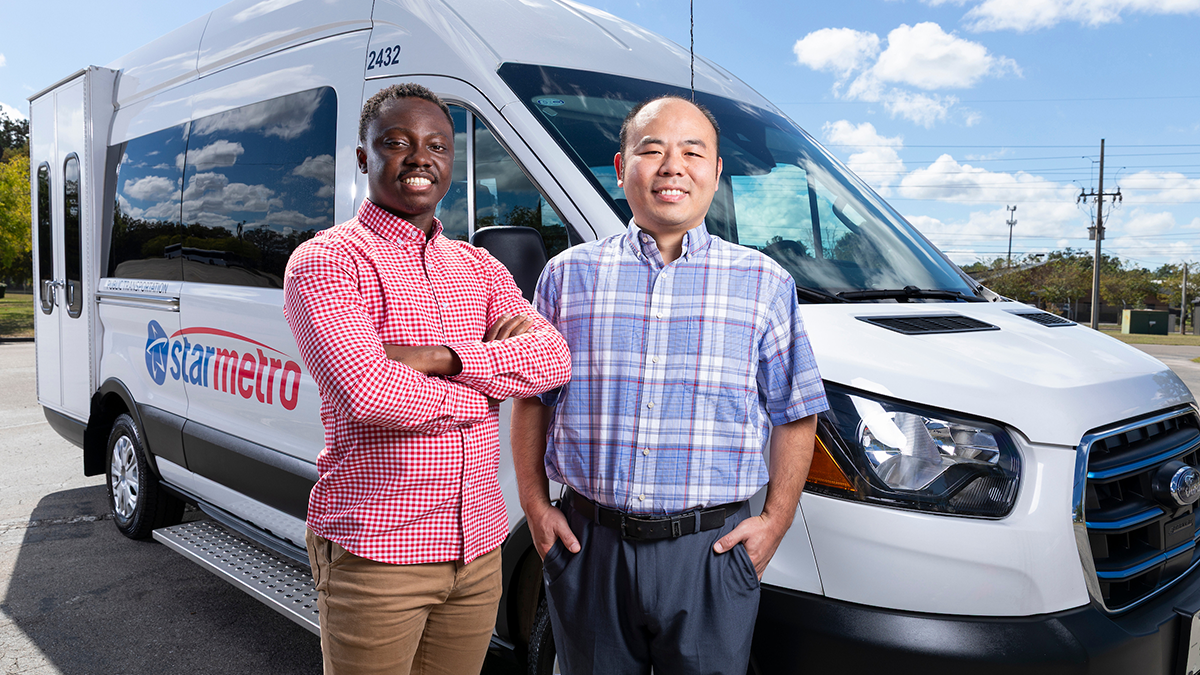
Doctoral student Chinonso Okorie (left) and Associate Professor of Industrial & Manufacturing Engineering Yanshuo Sun, Ph.D., pose with a StarMetro paratransit vehicle in Tallahassee, Florida on October 1, 2026. The pair of researchers is harnessing advanced mathematical methods to make paratransit services more reliable, efficient and accessible for all who rely on them. (Scott Holstein/FAMU-FSU College of Engineering)
Key Points
Researchers developed optimization models for drawing paratransit service zone boundaries. Large U.S. paratransit systems split their territory into zones, each run by a different provider, which forces some riders with disabilities to transfer vehicles mid-trip.
The team’s custom algorithm, tested on real data from a U.S. city with about 4,300 daily paratransit rides, found balanced zone boundaries in under seven minutes, compared with up to three hours for standard software.
The study, published in Transportation Research Part C: Emerging Technologies, shows agencies can use their own trip data to weigh provider workload balance against rider transfers.
For millions of Americans with disabilities or limited mobility, paratransit is a lifeline. It connects riders to employment, medical care and community resources. However, as demand rises in major cities, service gaps can make access challenging, especially at the edges of service zones.
In a new study, researchers from the Department of Industrial and Manufacturing Engineering at the FAMU-FSU College of Engineering are harnessing advanced mathematical methods to make paratransit services more reliable, efficient and accessible for all who rely on them.
The team introduces a data-driven decision-making approach to redefining service zone boundaries. The approach aims to break down travel barriers, streamline rides and make daily life easier for people who depend on accessible transit.
Their work was recently published in the journal Transportation Research Part C: Emerging Technologies.

Why do large cities divide paratransit into service zones?
In smaller communities, paratransit services, such as curb-to-curb or door-to-door rides for people with disabilities or limited mobility, are often managed through a single, centralized system, making coordination straightforward and efficient.
But for large cities, the sheer size of the service area means agencies must divide up their territory into multiple zones, each run by different providers.
This can be a hassle for riders. If their trip crosses into another zone, they often have to change vehicles partway through. What should be a simple trip, like visiting the doctor, can end up taking much longer, with extra waiting and annoying transfers.
“Our research looks at how to draw zone boundaries, so each service provider gets a fair share of the work,” said Yanshuo Sun, an associate professor in the Department of Industrial and Manufacturing Engineering at the FAMU-FSU College of Engineering. “This also reduces the number of trips that cross between zones. Major cities like Boston and Los Angeles already use three to six zones.”
Sun’s research team includes Chinonso Okorie, a doctoral candidate at Florida A&M University, and Shijie Chen, who earned his doctorate at Florida State University during the project.
How does the optimization model draw better zone boundaries?
The researchers set out to create two models to help decide where to set zone boundaries. They also developed an algorithm to speed up the process.
The first model is simple: it draws one straight line across the service area. This helps build a basic understanding of how boundaries work.
The second model is more practical. It uses several connected road segments to create boundaries that match real features like rivers, city borders or county lines. These are the same types of boundaries transit agencies use.
Solving the realistic model for a big city is complicated, so the team designed a custom algorithm that finds a near-optimal solution much faster than standard commercial software.
“To the best of our knowledge, this is the first study to apply these kinds of rigorous optimization models to paratransit service zone design,” Okorie said. “Up to now, transit agencies have largely relied on intuition or pre-existing boundaries like city limits rather than an actual quantitative method.”
What did the paratransit study find?
The team tested their method using real trip data from a U.S. city with about 4,300 daily paratransit rides. Their algorithm found balanced zone boundaries in less than seven minutes. The same task could take regular software up to three hours or require agencies to do it manually.
“We found an important trade-off,” Okorie said. “If you focus on balancing the workload between zones, more riders have to switch vehicles. If you want fewer transfers, the workload across providers becomes less evenly distributed. Transit planners can choose what matters most for their city: keeping providers equally busy or making trips simpler for riders.”
Why does data-driven zone design matter for transit agencies?
Zoning is already standard practice in major paratransit systems, such as Boston’s MBTA and Los Angeles County’s service. Yet the team found little research on how to draw those lines with data-driven methods, rather than relying on intuition or existing geography.
“Our approach fills that gap,” Chen said. “Agencies can input their own trip data and our method returns boundaries that balance provider workloads while minimizing rider transfers. It’s a practical decision-support tool for any large paratransit agency.”
What comes next for the research?
“Our core model divides a service region into two zones, but we’ve already shown how it can be extended to more zones,” Sun said. “We’re working on testing the approach in more cities and considering how to account for changing travel patterns over time.”
The researchers believe their methods could eventually help agencies running other on-demand, shared-ride services, including microtransit programs now being piloted in areas such as Miami-Dade and Jacksonville.
How did the project support student researchers?
Student success was closely tied to the project’s achievements. Okorie’s leadership and research contributions earned him two major scholarships. The first, a $5,000 award from the Florida Public Transportation Association and the Florida Transit Association Finance Corporation, goes to just one student statewide each year. The second is the $7,500 Shirley DeLibero Scholarship from the American Public Transportation Association. Both recognized his academic achievement and the direct contribution of this research to improving transportation.
Chen also advanced his career through the project, earning his doctorate and receiving the American Public Transportation Foundation Scholarship in 2023. He now applies the skills he developed during the research as an optimization engineer at Uber.
Who funded the paratransit research?
The research was funded by the Advancing Community-Centric Transportation Systems (ACTS) Center, a U.S. Department of Transportation-funded research center housed at the FAMU-FSU College of Engineering. Sun directs the center, which brings together a consortium of five academic institutions.
Editor’s Note: This article was edited with a custom prompt for Claude Opus 5.5, an AI assistant created by Anthropic. The AI optimized the article for SEO/GEO discoverability, improved clarity, structure and readability while preserving the original reporting and factual content. All information and viewpoints remain those of the author and publication. This article was edited and fact-checked by college staff before being published. This disclosure is part of our commitment to transparency in our editorial process. Last edited: 10/13/2026.
RELATED ARTICLES
Designing a Better System for Disadvantaged Travelers and Providers
Making paratransit buses safer
FAQ
Paratransit is a shared-ride transportation service, often curb-to-curb or door-to-door, for people with disabilities or limited mobility who cannot use fixed-route buses or trains. Riders use it to reach jobs, medical appointments and community resources.
Large cities often divide paratransit service areas into multiple zones run by different providers. When a trip crosses from one zone into another, riders may have to switch vehicles partway through, which adds waiting and travel time.
A team led by Yanshuo Sun in the Department of Industrial and Manufacturing Engineering built two optimization models and a custom algorithm that draw zone boundaries along real features such as road segments, rivers and county lines. The method balances workloads among providers while limiting trips that cross between zones.
In a test using trip data from a U.S. city with about 4,300 daily paratransit rides, the algorithm found balanced zone boundaries in less than seven minutes. The researchers report that standard commercial software could take up to three hours for the same task.
The researchers found that balancing workloads evenly among providers increases the number of riders who must transfer, while minimizing transfers makes workloads less even. Transit planners can choose which priority fits their city.
The study was funded by the Advancing Community-Centric Transportation Systems (ACTS) Center, a U.S. Department of Transportation-funded research center housed at the FAMU-FSU College of Engineering in Tallahassee, Florida. Yanshuo Sun, an associate professor of industrial and manufacturing engineering who led the study, directs the center.